i-Hunting : GPS Maps App 105.0.0
Continue to app
Free Version
Publisher Description
Offline Topo Maps w/t parcels, property lines, Hunt Layers & PLSS. Must for Hunting, Surveying, Hiking & Biking.
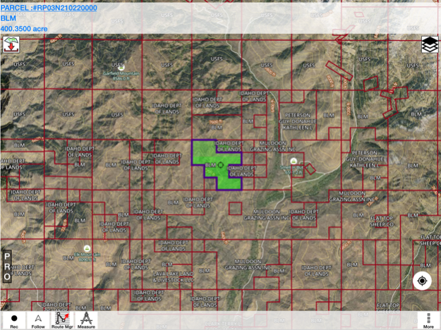
This hunting GPS app provides access to property line maps, parcels & public
lands, land ownership details. Map layers for 50+ states include hunting
zones, restricted areas, possible access areas, state refgues and more.
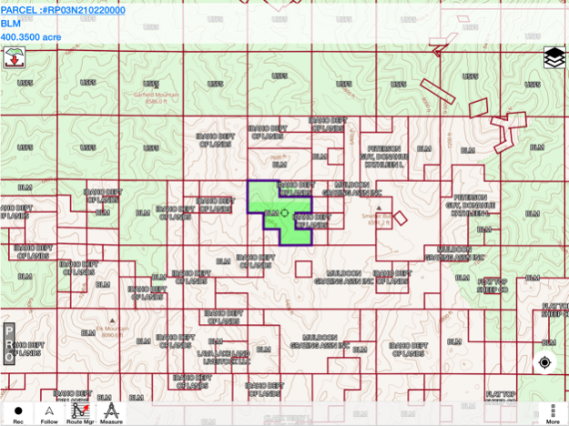
Vector topo maps with most accurate USGS elevation contours, hiking & biking
trails. Coverage includes all US states.
► Vector Topo Maps
√ Beautiful & detailed Hardware/GPU accelerated vector maps (text stays upright on rotation)
√ Vector USGS contours (Change height to ft or meter).
√ Covers popular hiking & biking trails and paths
► Parcel Maps
√ Includes following ownerhsip attributes (where available)
* Owner name and Owner address
* Site Address
* Parcel ID Total Value
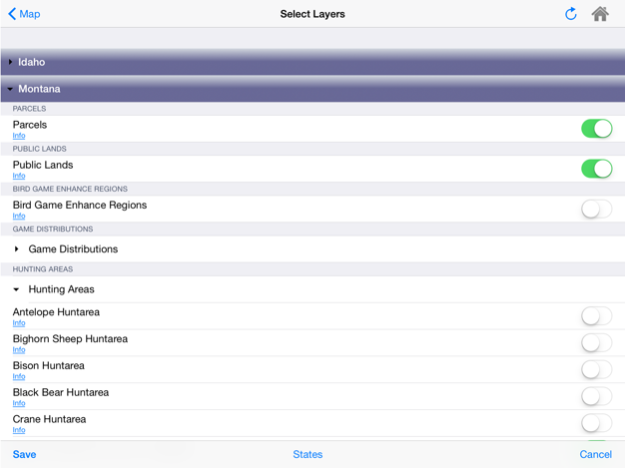
► Hunt Planning maps
√ Possible Public Access
√ Public lands and Parcels
√ Hunting Zones
√ Game Distribution
√ Restricted Ares
√ Portions
► Offline vector maps
√ Easy to download offline topos
► PLSS maps
√ PLSS Townships and Sections (US Wide coverage)
► Custom base maps
√ Switch base maps between vector topos, hybrid satellite imagery and more
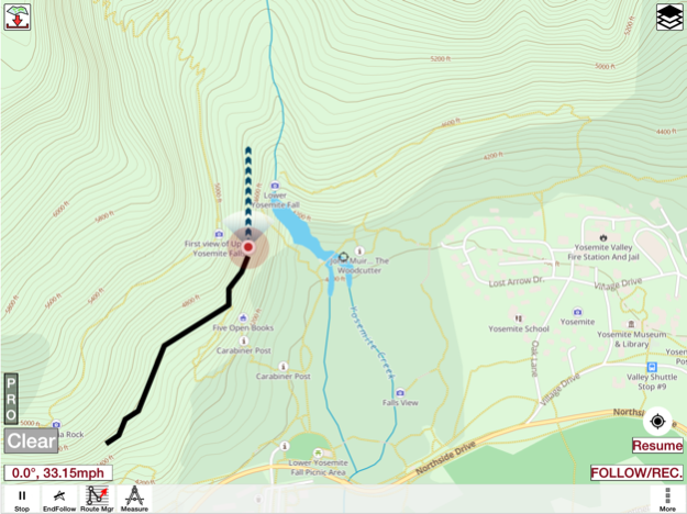
►GPS FEATURES
√ Record Tracks
√ Enter or import Waypoints.
√ Auto Follow
* Real Time Track Overlay
* Predicted Path Vector
* Course Up(Text stays upright)
* Speed & Heading
√ Route Assistance With Voice Prompts
* Prompts when approaching a boating route marker
* Continous distance & ETA updates
* Alerts when off route
* Alerts when moving in wrong direction
►ROUTE MANAGEMENT / TRIP PLANNING
√ Create New Route/Edit Existing Routes
√ Move Points
√ Add points to an existing route leg
√ Delete / Rename points
√ Import GPX,KML & KMZ files
√ Plot/Edit Routes
√ Enter Waypoints
√ Share/Export Routes,Tracks&Markers
√ Reverse Routes
►Solunar Forecast
* Sun Rise, Sun Set
* Moon Rise, Moon Set, Moon Transit, Moon Phase
* Major & Minor activity times
* Day Scale
► SHARING
* Share tracks/routes/markers on Facebook & Twitter
* Export tracks/routes/markers as compressed GPX files.
Oct 28, 2023
Version 105.0.0
- Parcel data updates for selective townships and counties
- Compiled with latest version of Xcode
About i-Hunting : GPS Maps App
i-Hunting : GPS Maps App is a free app for iOS published in the Recreation list of apps, part of Home & Hobby.
The company that develops i-Hunting : GPS Maps App is Bist LLC. The latest version released by its developer is 105.0.0.
To install i-Hunting : GPS Maps App on your iOS device, just click the green Continue To App button above to start the installation process. The app is listed on our website since 2023-10-28 and was downloaded 5 times. We have already checked if the download link is safe, however for your own protection we recommend that you scan the downloaded app with your antivirus. Your antivirus may detect the i-Hunting : GPS Maps App as malware if the download link is broken.
How to install i-Hunting : GPS Maps App on your iOS device:
- Click on the Continue To App button on our website. This will redirect you to the App Store.
- Once the i-Hunting : GPS Maps App is shown in the iTunes listing of your iOS device, you can start its download and installation. Tap on the GET button to the right of the app to start downloading it.
- If you are not logged-in the iOS appstore app, you'll be prompted for your your Apple ID and/or password.
- After i-Hunting : GPS Maps App is downloaded, you'll see an INSTALL button to the right. Tap on it to start the actual installation of the iOS app.
- Once installation is finished you can tap on the OPEN button to start it. Its icon will also be added to your device home screen.
